Rights of Way in Britain - Walks Around Britain

Go to content

Our Guide to Public Rights of Way


What are Public Rights of Way?

A Public Right of Way in England and Wales is a highway which can be used by the public by the public at all times - and here, a highway means footpaths, bridleways and byways instead of the American meaning of a major road.

Public Rights of Way can be on any land, including privately owned land.  It is an offence to wilfully block free passage along a Public Right of Way without lawful authority or excuse.  If you come across an illegal obstruction then you have the right to take a short detour around it or remove it as much as is necessary to get past.  Click here for our advice of what to do if a Public Right of Way is blocked.

On all types of Public Right of Way you can take a pushchair or wheelchair if the path is suitable, although many are across farmland so may have an uneven surface and may have gates or stiles.  You are also allowed to have a small picnic on Public Rights of Way, but remember to take your litter home.  You are allowed to take photographs whilst on Public Rights of Way - even if what you are taking photographs of isn't on the Public Right of Way.

You can also take a dog, but they must be kept under close control, especially when near livestock. Please be a responsible dog owner and clean up after your dog - it is an offence to allow your dog to foul on a Public Right of Way.  Also make sure your dog does not stray off the path or you may be committing trespass against the landowner, and you could be asked to leave.

Types of public rights of way

There are four different types of Public Rights of Way in England and Wales - and these may be marked along their route with signposts and coloured arrows…

Footpaths (Yellow arrow)

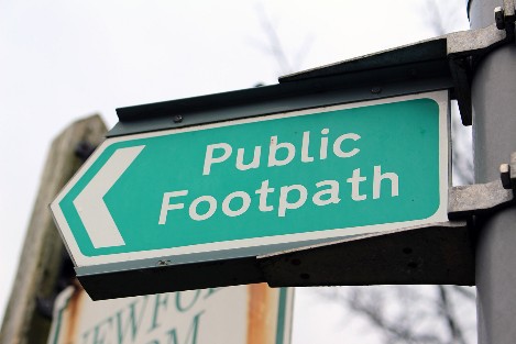
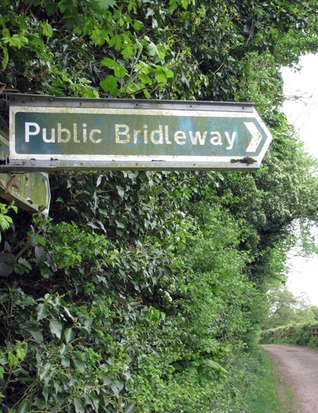
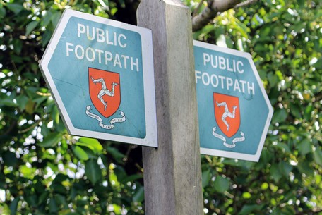
Footpaths are for walkers
- including prams, pushchairs and wheelchairs - but remember that some paths, particularly those in the countryside, may not be suitable for them.  Dogs are allowed on Public Footpaths although you may have to keep it on a lead or under close control.

There is no right to ride a cycle along a public footpath, although individual landowners may permit cycling on some routes which are public footpaths - and these are usually signed to indicate that cycling is permitted.

Bridleway (Blue arrow)

Bridleways are for walkers, horse riders and cyclists.  You can also lead a horse along a bridleway.  
Cyclists must give way to walkers and horses.  You should be aware that some bridleways are not physically suitable for cycles.
Restricted Byway  (Plum arrow)

Restricted byways are for walkers, cyclists, horse-riders and horse-drawn vehicles.  
Mechanically propelled vehicles are not allowed on restricted byways.

Byway open to all traffic  (Red arrow)

Byways open to all traffic (or BOATs for short) are for walkers, cyclists, horse-riders, horse-drawn vehicles and motor vehicles.

How to find rights of way

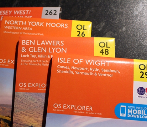
Ordnance Survey
(OS) maps are the easiest way of finding out rights of way in a particular area.  The most useful OS maps are Explorer series (1:25,000 scale) - these show all public rights of way in green, and permissive paths in orange.  The Landranger series (1:50,000 scale) show public rights of way in red but doesn't show as much detail.  


You can buy OS maps online here or if you just want to look at an area, Bing Maps
have both 1:25,000 and 1:50,000 scale OS maps on their website.

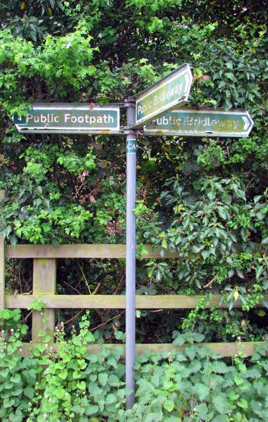
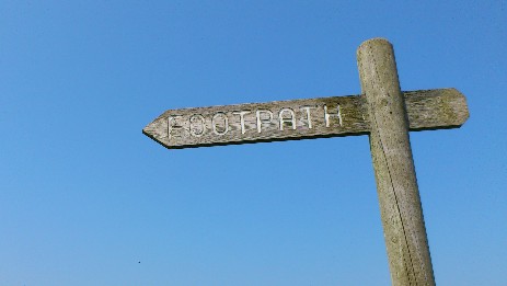
When you're out and about, rights of way are often signposted with the coloured arrows as described above - or with the familiar green finger signposts (blue, if the route is also a cycle route).

Does anyone have a definitive list of Public Rights of Way?

Yes, in England and Wales local councils must record the existence and locations of rights of way and make sure this information is available for public use.  This is called the Definitive Map and will be available to view during office hours at a local council office.  It may also on the web as several councils have online walking route planners based on the Definitive Map in their area.

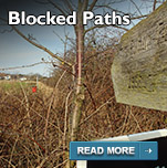
Problems in using a right of way

If you have a problem using a right of way because of an obstruction, poor maintenance or a misleading sign, you could help others using the path after you by reporting it to:

  • the National Park Authority if it's in a national park
    the local highway authority for land outside national parks - you can contact them through your local council
  • the Forestry Commission in woodland


Local authorities, landowners and land occupiers all have a duty to keep public rights of way open and useable.


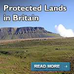
Other types of rights of way

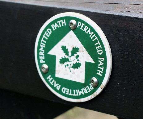
There are other types of paths - often called 'Concessionary', 'permissive' or 'permitted' paths.  These are not public rights of way as of right, but are paths along which the landowner permits people to walk or ride.  The permission may be limited to certain types of user, like only walkers.  The permission may be a written agreement or just verbal and may be withdrawn by the landowner at any time.


Permissive paths will usually be closed for at least one day a year to ensure claims of a continous right of way can not be made against the landowner.

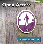
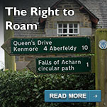
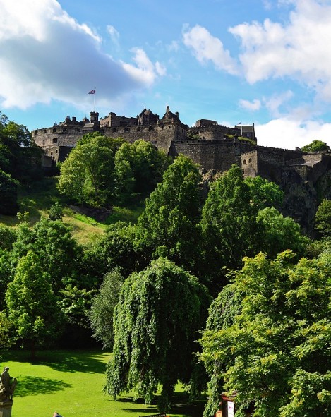
Rights of way in Scotland

In Scotland
, a right of way is treated differently to those in England and Wales.  A Scottish right of way is any route over which the public has been able to pass for at least 20 years and must link two public places, for example, a village, church or road.

Unlike England and Wales, Scottish local authorities don't have to signpost or mark a right of way
or maintain a Definitive Map of Rights of Way in their area.  Because of this - and Scotland's wider 'Right to Roam' - Ordnance Survey maps for Scotland don't show Rights of Way.

The charity Scotways has compiled the best record of Scottish Rights of Way, in partnership with Scottish Natural Heritage and with the co-operation of local authorities.  This is called the National Catalogue of Rights of Way (CROW) - and shouldn't be confused with CRoW - with the lower case 'o' - which is the Countryside and Rights of Way Act in England and Wales.


CROW records almost 7,000 rights of way, with a total length of just over 9,300 miles.  That makes the average length of a Scottish right of way only just over 1⅓ mile.  This doesn't sound a lot given its size, but remember Scotland has Core Paths and The Right to Roam - more details here - so there's lots of walking to be accessed throughout the country.
Rights of way on the Islands of the British Isles

The Crown Dependances of the Isle of Man and the Channel Islands have Public Rights of Way which are similar to those in England and Wales.

On the Isle of Man, public footpaths are public rights of way where the public have a right to pass on foot only.

  • Bicycles should not be taken onto public footpaths.
  • Walkers are allowed to take dogs on Public Rights of Way, but they must be kept under close control - either on a lead or walking to heel.
  • Dogs must not be allowed to run free accross fields or on land adjacent to the footpath.

On Jersey, Guernsey, Alderney and the other Channel Islands have similar regulations on Public Footpaths.

About Us

Join us for short walks and walking info from Britain's leading digital walking destination
Walking routes, information, walking festivals, gear reviews
on the website, social media, radio/podcast, DVD, books and television.
Back to content