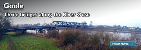
Walks from Season Three - Huggate to Thixendale
A short walk along part of the 79 mile Yorkshire Wolds Way, from Huggate to Thixendale - proving there's great little walks to be done along the epic lengths of England and Wales' National Trails.
This is a linear walk - and be aware there isn't any public transport between Thixendale and Huggate, so please make your way back to Huggate by booking a taxi or by taking a walking buddy and leave a second car at Thixendale first. Or you could walk back, of course!
If you've done this walk, we'd love to see your photos and videos. Share them with us on Twitter, Facebook or Instagram.
The full walk is available to watch on Walks Around Britain+, our "Netflix for Walking" video subscription website - click here for a 7 day free trial.

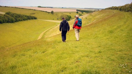
The Dry Valleys along this route
A walk from Huggate to Thixendale on the Yorkshire Wolds Way - Walks Around Britain Shorts
Walk Info
Distance | 6½ miles (10.4 km) |
Minimum time | 4 hours |
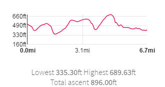
Total ascent | 896 ft (273m) |
Level of difficulty | Easy |
Paths | Public footpaths and pavements 3 gates |
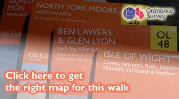
Map | |
Start/finish | Grid SE 88164 55510 |
Dogs? | Keep on leads |
Parking | Off-road in Huggate |
Public Transport | No public transport available |
Toilets/Refreshments | In Fridaythorpe and Thixendale |
Gradient Profile

Share this walk
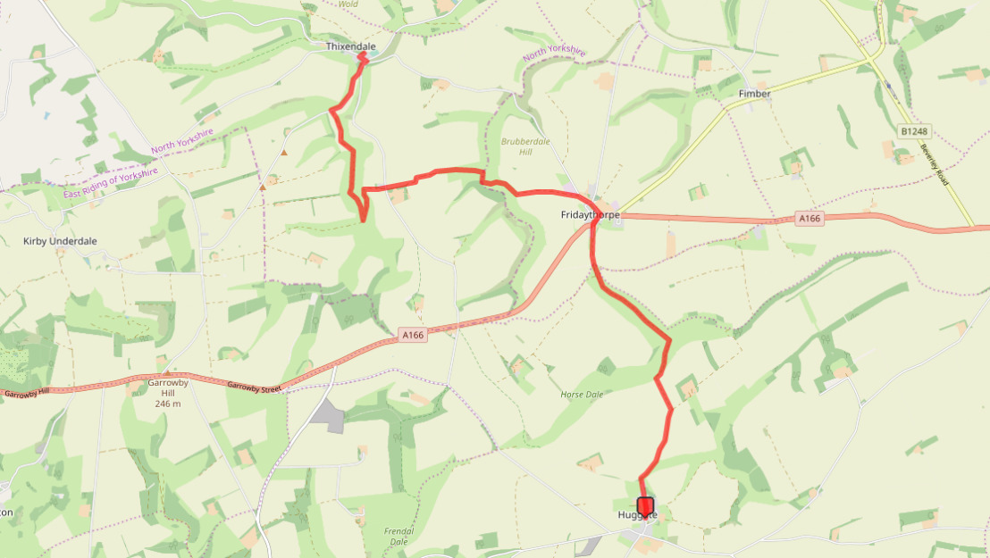
Route Directions
- Start by parking considerately off road in the village of Huggate.
- With the church on the right of you and the road into Huggate behind, walk forwards - which is northerly - upon the road through the village.
- When the road turns to the right, the Yorkshire Wolds Way joins this road from the left - and you are now walking on the Yorkshir Wolds Way.
- In a short while, a junction in paths sees the Chalkland Way go to the right folk of the "Y" junction down Cow Dale, as the Yorkshire Wolds Way takes the left.
- The path heads through open fields here.
- At the next junction of paths, take the left hand route and head in a straight line to the far side of the field.
- Go through the gate, turn right, and follow the obvious worn path down the side of the dry valley called Horse Dale.
- Just as the path reaches the bottom of the valley, there's another junction - take the left fork to continue along the Yorkshire Wolds Way.
- Follow the path through Holm Dale and at the next junction of paths, take the right hand route.
- At the end of the valley, a lone tree on the right hand side indicates where the next gate is.
- After the gate, our path is crossed by a track at right-angles. Carry on straight ahead along a farm path.
- Soon, Glebe Farm is passed on the right.
- The path finishes as it joins the busy A166. Cross this road carefully, and turn right.
- Continue alongside the A166 Main Street until you reach "The Farmers Arms" pub, and turn left down Back Street.
- Follow the road, with the duck pond on your left, and stay on this road after it renames as Thixendale Road.
- At the next fork, Thixendale Road heads right, and the Yorkshire Wolds Way follows the track on the left. Take the left path to continue on the Way.
- Follow the path as it crosses fields and then decends down the side of West Dale.
- Here, the path rises again fairly steeply along Brubber Dale towards Gill's Farm.
- Cross the road called Huggate Hill and follow the path waymarked Thixendale 2 miles.
- Remember this section is a Bridleway and so there might be bikes or horses along the route.
- The path takes a left and then a right in order to decend to the bottom of Thixen Dale - another of the dry valleys.
- At the end of the valley, the Yorkshire Wolds Way turns left at the un-named road which heads in the opposite direction to the village of Painsthorpe.
- The road you previously crossed, Huggate Hill, joins on the right. Remain on this road signposted to Thixendale.
- At the next road junction, turn left into Thixendale village.
- Then, a right takes you to the end of this walk at The Cross Keys pub.
- As there isn't any public transport links between Thixendale and Huggate, you either need to walk back or phone for a taxi to return to you car.
Print this page
Relevant Links
National Trails - Yorkshire Wolds Way
Information about walking the 79 miles of the Yorkshire Wolds Way from the offical National Trails website.
Information about walking the 79 miles of the Yorkshire Wolds Way from the offical National Trails website.
Yorkshire Wolds Way: National Trail Guide
Buy the offical National Trail Guide guidebook for the Yorkshire Wolds Way.
The new third edition of the AA Guide to Yorkshire gives you everything you need to know to get the most out of your visit to this wonderful county - and written by our own Andrew White.
If you enjoyed this walk, you might like these...