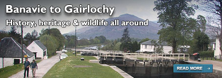
Walks from Season Two - Muirtown Basin
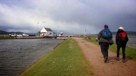
A short 2 mile walk around the Muirtown Basin at the Inverness end of the Caledonian Canal. Perfect for a lunchtime walk - or even between connections between trains at Inverness Railway Station - but be warned - the wind can be a bit strong at the exposed Clachnaharry Sea Lock.
If you've done this walk, we'd love to see your photos and videos. Share them with us on Twitter, Facebook or Instagram.
The full walk is available to watch on Walks Around Britain+, our "Netflix for Walking" video subscription website - click here for a 7 day free trial.

Welcom to Walks Around Britain
Walk Info
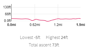
Distance | 1.9 miles (3km) |
Minimum time | 1 hour |
Total ascent | 73 ft (22.3m) |
Level of difficulty | Easy |
Paths | Canal towpaths - on the flat throughout - very exposed |
Map | |
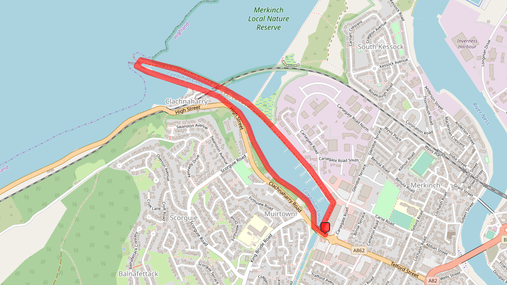
Start/finish | Grid NH 65451 45972 |
Dogs? | Keep on leads - exposed deep water around |
Parking | Muirtown Basin Car Park |
Public Transport | |
Toilets/Refreshments | None nearby |
Gradient Profile

Share this walk
Route Directions
- If you are arriving at the Muirtown Basin by bus, get off at the Cameron Road stop (stop id 45324794) and walk along Telford Street, over the roundabout into the shopping estate and right into the basin area.
- If you are arriving by car, there's limited car parking in the basin area off Telford Road.
- The walk doesn't go inside the Scottish Canals compound, as you might think, but along the open road to the right.
- Follow the road, and when it turns to the left, make sure you keep to the right and walk with the buildings on the left.
- Soon, this road becomes a path and joins alongside the canal basin.
- Here, many of the house boats moored in the basin are situated.
- Carefully cross over the railway, and then on the right is the Merkinch Local Nature Reserve.
- Walk to the end of the tow path - and this is Clachnaharry Sea Lock, where the Caledonian Canal meets the Beauly Firth.
- Look out for the monolith sign for the Caledonian Canal and the various national flags flying in the wind.
- Carefully cross over the canal using the lock gates as a bridge, and walk back along the other side of the canal.
- Here, you get a better look at the railway swing bridge on the left as you cross the railway line again.
- After the railway, the old works buildings are on your right - along with a plaque commemorating the twinning of the Caledonian Canal with the Göta Canal in Sweden.
- Walk along the canal tow path and go through the gates at the end onto Telford Street.
- Turn left and cross over the canal to get back to your car - or turn right for the nearest bus stops further up Clachnaharry Road.
Print this page
Relevant Links
Scottish Canals - Discover the Caledonian Canal
Find out more about the massive Caledonian Canal and what you can do on and aong it.
The website for the Merkinch Local Nature Reserve, which is on the right as this walk starts off. Find out about the history of the reserve and why it is so important.
If you enjoyed this walk, you might like these...