Walks from Season Five - Misterton to West Stockwith
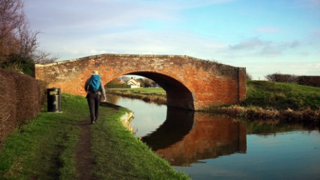
Water is a constant companion on this walk, as you bimble alongside a canal and two rivers between the Nottinghamshire villages of Misterton and West Stockwith.
If you've done this walk, we'd love to see your photos and videos. Share them with us on Twitter, Facebook or Instagram.
The full walk is available to watch on Walks Around Britain+, our "Netflix for Walking" video subscription website - click here for a 7 day free trial.

Welcome to Walks Around Britain

Walk Info
Distance | 3½ miles (5.7km) |
Minimum time | 1½ hours |
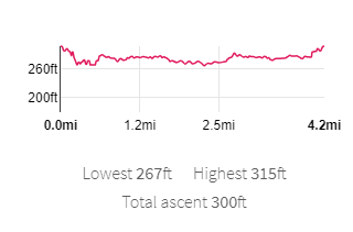
Total ascent | 150 ft (??m) |
Level of difficulty | Easy |
Paths | Well defined footpaths and canal towpaths 4 gates |
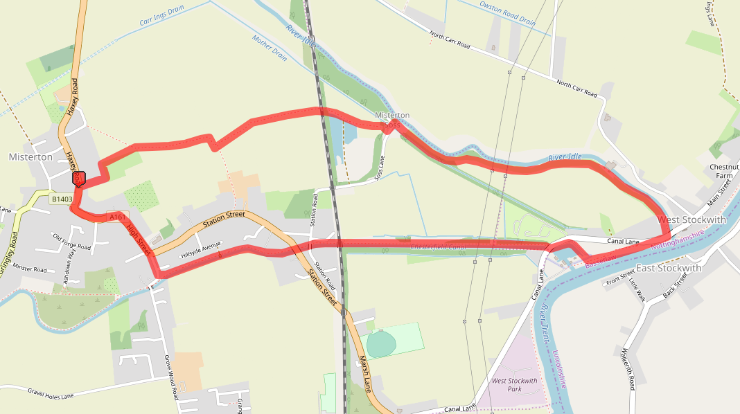
Map | |
Start/finish | Grid SK 76526 94868 |
Dogs? | Kept on leads along the canal, but off-lead along the River Idle |
Parking | Off-road car parking in Misterton - A161 Haxey Road |
Public Transport | Bus |
Toilets/Refreshments | In West Stockwith |
Gradient Profile

Share this walk
Route Directions
- Park off road along the A161 Haxey Road, parking considerately for local residents.
- Walk down Haxey Road towards the church.
- Near B1403 Church Street, cross over Haxey Road to enter the grounds of the church for a closer look.
- Once finished in the church, turn right onto the A161 - what is now called High Street.
- Cross over Meadow Drive, and continue along High Street.
- High Street turns right, and follow it down past the Methodist Church on the right.
- At the point where the A161 turns left - and becomes Station Street - continue straight on down Wharf Road.
- Wharf Road turns right, on the opposite side of the road is the gate for the access to the canal towpath. Carefully cross Wharf Road and go through the gate.
- Turn left, so that the canal is on your right hand side.
- Walk along the canal towpath. Go underneath the low arched bridge.
- Drop down alongside the lock gates at Misterton High Lock.
- Walk underneath the A161 road bridge and past Misteron Low Lock. Go underneath another road bridge - this time Soss Lane.
- Walk past the various buildings on the left and underneath the railway line bridge.
- Now continue along this long, straight section of canal, with the house boats on the far side of the water.
- Go around the black and white gates and under a road bridge for Canal Lane.
- This is now Stockwith Basin. Follow the basin around to the opposite side and turn left to walk alongside the River Trent.
- When the path joins the road, cross over and turn left down a path marked with a footpath sign.
- Follow the path alongside the River Idle, past the flood gates and the sluice.
- Keep following the path and a drain runs close on the left hand side.
- At the buildings, turn left at a footpath sign marked "Misterton 1" and then turn right on another footpath.
- Follow the clear path through the field and climb up to carefully cross over the railway line.
- At the other side, the path is clear through the fields, with the Misterton's church spire helping with navigation.
- The path turns right to follow the line of trees, crosses a footbridge and turns left.
- The path is clearly visible and when it reaches the gardens of houses, it turns left and then right to reach the A161 Haxey Road.
Relevant Links
Chesterfield Canal
Information about the restoration of the Chesterfield Canal, part of which this walk follows.
If you enjoyed this walk, you might like these...